
Monitoring coastal vulnerability to marine erosion in Comoros
WIOMSA 12th symposium, poster presentation
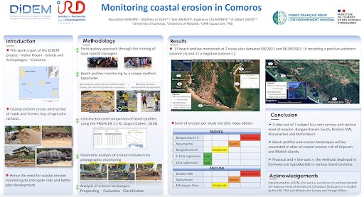
Conséquences de l'érosion côtière, Comores @ Nourddine Mirhani
Authors
Nourddine MIRHANI (CUP, Univ. of Comoros), nourddine_mirhani@yahoo.fr
Matthieu LE DUFF (Univ. center in Mayotte), matthieu.le_duff@univ-mayotte.fr
Yann MERCKY (Univ. center in Mayotte), yann.mercky@univ-mayotte.fr
Espérance CILLAURREN (IRD, UMR Espace Dev), esperance.cillaurren@ird.fr
Gilbert DAVID (IRD, UMR Espace Dev), gilbert.david@ird.fr
Click on the poster to open it in full page
Background
Erosion affects a large part of the WIO coastlines and it is likely to increase in the future with the sea level rise driven by global warming. In this context, monitoring coastal erosion is a key tool for planning policies to adapt to global warming at the regional, national and local levels. Comoros islands are particularly exposed and vulnerable to coastal erosion. Coastal monitoring focuses on coastal vulnerability and deals with low-cost and participatory methods.
Method
In a first step, a diagnostic of coastal erosion based on in situ observations was carried out at the island scale. Based on landscape analysis, a set of eighteen indicators of coastal erosion were produced: erosion slopes, outcrop of beach-rock... They drive a hierarchy and classification of monitoring sites in terms of erosion processes and their intensity. In each of them a diachronic analysis of aerial photographs and satellite images over the period 1950-2020 were carried out.
In a second step, in situ monitoring protocol for erosive processes and morphological dynamics of beaches was deployed in demonstration sites. Two main sites were selected in Anjouan island, Mtsangani Sima and Al-amal, and three main sites in Moheli: Fironi Dzia Lagnouma, Dzia Lagnouma and Bangachareni. Inspired by Emery's method (1961) for establishing time series of beach profiles, this monitoring protocol is simple and inexpensive.
Result
The sites studied are characterized by beaches of coral and mixed sand (coral and terrigenous) backed by terraces and/or cliffs. Their vulnerability to erosion is materialized by the appearance of concave beach profiles, beach-rocks, erosion slopes, notches at the base of the cliff, uprooted trees, collapsed structures... The erosion indices revealed that 50-75% of the beach at Nioumachoi and the cliff lined beach at Bangachareni have reached serious and very serious levels of erosion respectively. Dwellings, protective walls and agricultural plots are the most exposed and vulnerable to the hazard.

Mise en place des bornes GPS à Moheli @N.Mirhani
Conclusion
The methods and protocols deployed here are easily reproducible and deployable in various contexts. They can be carried out easily by coastal users and watchers, including marine parks staff, students, village associations members, after several hours of training. Monitoring beach profiles and erosion’s landscape indicators are the first steps of a participative observatory of coastal vulnerability to erosion in Comoros.
Read the poster :

Figure 2- Marine erosion monitoring sites in Chissiwani National Park (08/2021-02/2022)

Monitoring the profile of the Mtsangani Sima beach using topometer measurements @N. Mirhani