CNRE's infrastructure and know-how (WIODER team, then DiDEM/Deltas-Madagascar) were mobilised for the SWOT (System Water Ocean Technology) mission, which brought together 7 researchers from CNES, CNRS, INSU, IRD (LEGOS, SENS), CNRE and IOGA on the Tsirinbihina River, the only navigable river in western Madagascar, from 2 to 9 May 2022.
Madagascar has been chosen, along with ten other countries, to test the SWOT satellite, which will be launched in November 2022 and will provide daily water level data for Madagascar's lakes and rivers between March and May 2023, followed by data every 21 days for a period of 15 years.
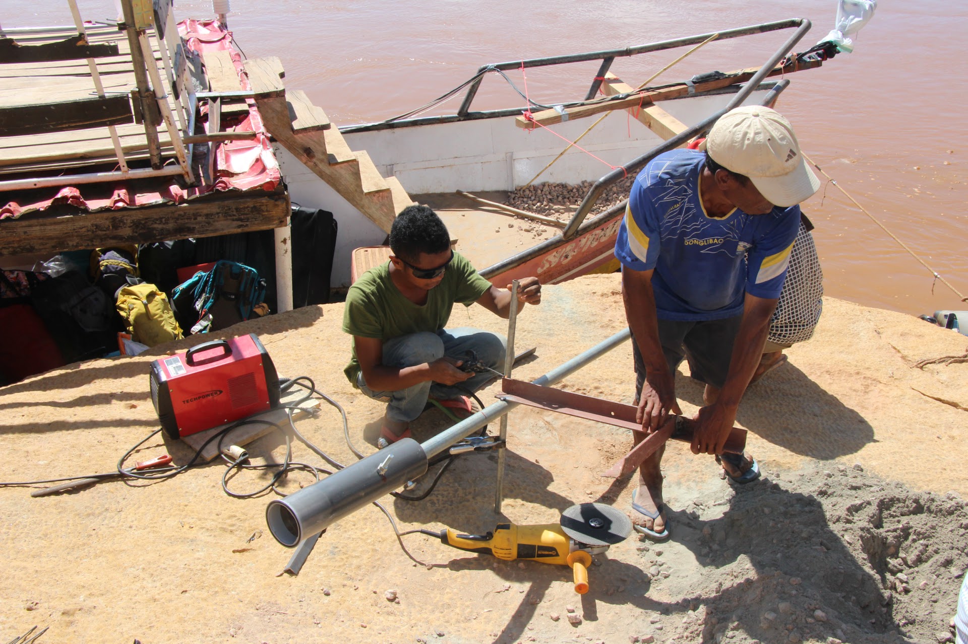
In May 2022, this team of researchers equipped a boat to sail up and down the Tsirinbihina River and measure the slope of the riverbed and longitudinal bathymetry (relief of the riverbed), the speed of the current and the height of the water, and by zodiac pulling an ADCP, the transverse bathymetry on several crossings. Two pressure sensors linked to altimetry satellites have been installed on the bank, and an atmospheric pressure sensor on land, under the supervision of the local authorities, to continuously assess water height variations, data measured in situ that will be essential to validate the estimates by the SWOT satellite.
It is a major challenge over the next 15 years to improve the estimation of water levels thanks to the SWOT satellite at the global level (Franco-American project) and for Madagascar to obtain updated data on lakes and rivers, whereas the available data are those of ORSTOM (1970s) and IRD-CNRE since 2018 on four rivers in western Madagascar (Betsiboka, Ikopa, Mangoky and Tsirinbihina).
In April 2023, a second SWOT mission will take place on the Tsirinbihina, which is now better known, in order to test the satellite's estimates.
The aim of these observatories is to better monitor large rivers and lakes, and consequently deltas, of which there are many in Madagascar.